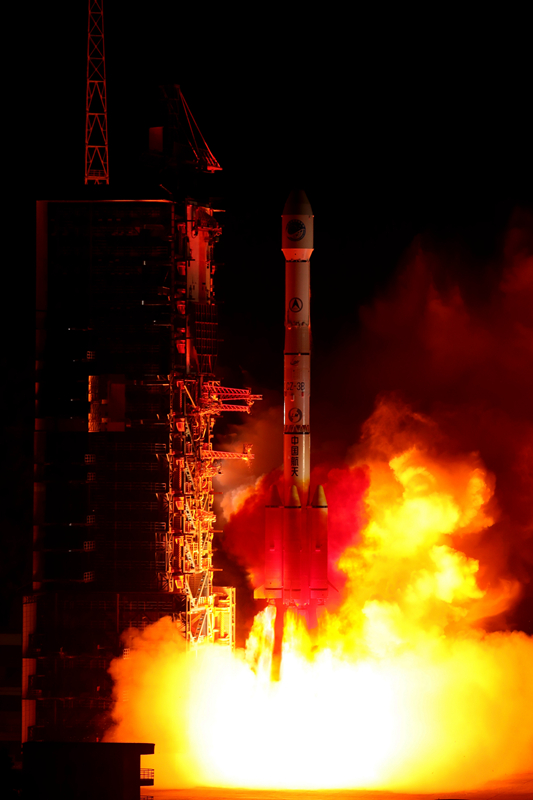
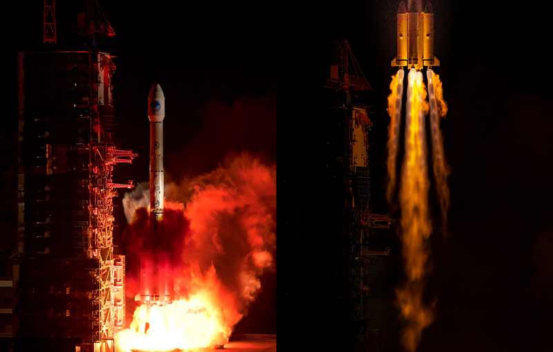
Hi for the 100th time! At 22:41 on April 20, our country successfully launched the 44th Beidou navigation satellite with the Long March 3B carrier rocket at the Xichang Satellite Launch Center. This is the 100th flight of the Long March 3A series of carrier rockets. This is the first tilted geosynchronous orbit satellite of the Beidou-3 system. It is understood that after the satellite enters the working orbit and conducts a series of in-orbit tests, it will be networked with 18 medium earth orbit satellites and 1 geosynchronous orbit satellite previously launched. "This hybrid constellation design containing three different types of orbiting satellites is unique to the Beidou system and the first in the world. It will effectively increase the number of satellites visible in the Asia-Pacific region and provide better services for the Asia-Pacific region." Beidou satellite navigation system engineering chief designer Yang Changfeng said.

At 22:41, the Long March rocket took off into the sky with orange-red flames and flew to the vast starry sky. This is the 302nd flight of the Long March series of carrier rockets and the 100th flight of the Long March 3A series of carrier rockets. As the only navigation system in the world composed of three kinds of orbital satellites, China’s Beidou has very high requirements for the rocket to perform the launch mission. Due to its strong adaptability, the characteristics of serving multiple orbital surfaces and high stability, the Long March 3A series of carrier rockets, including the Long March 3B, have become a veritable "Beidou special train". So far, it has successfully sent 4 Beidou navigation test satellites and 44 Beidou navigation satellites into the predetermined orbit through 36 launches. This launch is the first launch of Beidou navigation satellites in 2019. It is understood that the Beidou satellite navigation system will continue to have a high-density global network this year, and will launch 8-10 Beidou-3 networking satellites to complete all MEO satellite launches, further improve the global system constellation layout, and comprehensively improve the system service performance and user experience.
The Beidou satellite navigation system is a global satellite navigation system independently built and operated by our country. Yang Changfeng said that since the end of 2018, the system has been running smoothly. After global testing and evaluation, the positioning accuracy in the global region is better than 10 meters, and the positioning accuracy in the Asia-Pacific region is better than 5 meters, which meets the indicator requirements. According to the plan, in 2020, our country will fully complete the construction of the Beidou-3 global system and provide unique services. In 2035, our country will also build a more ubiquitous, more integrated and more intelligent integrated positioning and navigation timing (PNT) system with the Beidou system as the core. After years of development, the Beidou system has been applied on a large scale in our country’s transportation, agriculture, public security, surveying and mapping industries and the public sector. The sales volume of basic products such as domestic Beidou navigation chip modules has exceeded 70 million pieces. At the same time, our country has always adhered to the concept of "China’s Beidou, the world’s Beidou", and shared the development results of the Beidou system construction with the world.
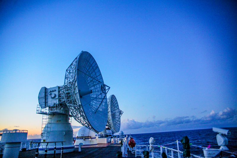
At present, the Beidou system has been widely used in the fields of construction in Kuwait, land surveying and mapping in Uganda, precision agriculture in Myanmar, warehousing and logistics in Thailand, and power inspection in Russia. "The Beidou system will serve the world and benefit mankind with stronger functions and better performance," Yang Changfeng said. At 22:41 on April 20, Beijing time, our country successfully launched the 44th Beidou navigation satellite with the Long March 3B carrier rocket at the Xichang Satellite Launch Center. The Yuanwang 3 ship successfully completed the maritime measurement and control task in the predetermined waters of the Pacific Ocean.
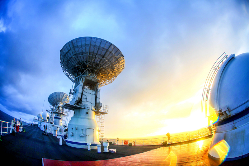
After the rocket took off for more than 20 minutes, the Yuanwang No. 3 ship discovered and successfully captured the target in time in the depths of the ocean thousands of miles away from the motherland. The onboard aerospace measurement and control equipment quickly received the rocket telemetry parameters, and at the same time carried out the measurement of the rocket and the satellite. Accurately send data to the Xi’an Satellite Measurement and Control Center and Xichang Satellite Launch Center.